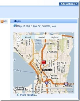
Add Virtual Earth Interactive Maps to your Search Server Site
Are you trying to think of ways to make your Search Server site more interactive and graphical? You can use Federation as a way to enhance the functionality of your search result pages.
The Federated Search Web Part makes it possible to display more than results from OpenSearch (1.0/1.1) sites on your search results page. The Search Server 2008 SDK explains how to include results from SQL Server database queries and search sites that do not expose XML feeds (such as Atom or RSS). In both scenarios, you do this by means of a "connector," a light-weight interface that sends queries to a given location or database, places the results into a structured XML document, and sends that XML to a Federated Search Web Part.
This sample demonstrates how you can extend the connector concept to Web service requests other than basic search queries. It shows how to use a connector to pass an address string to Microsoft's MapPoint Web service in order to obtain the latitude and longitude coordinates for that address. Once you have those coordinates, displaying a Microsoft Virtual Earth map requires only the addition of some Javascript to your Federated Location definition file. See this Codeplex project for the sample code (along with a sample Federated location definition file) and an explanation of how to implement it on your own site.
This sample is part of the Search Community Toolkit
Jim Crowley
Programming Writer
Microsoft Corp
Comments
Anonymous
April 03, 2008
Entwicklung Benutzer nach dem Erstellen eines Listen-Elementes auf die Eigenschaften-Seite umleiten HowAnonymous
October 22, 2008
Hi, Today reading Stephen P. Anderson book I realized that Information Architecture is to Findability
