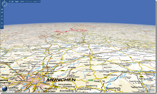
Virtual Earth and OGC WMS
Check out the new Virtual Earth map style using topographical maps.
Ha, gotcha! I should've saved this one for April 1.
This is actually an Open Geospatial Consortium Web Map Service integration with Virtual Earth! And, just to clarify, this is not a new map style. C+V Huber just launched a new tourist portal for a 2nd region in Bavaria - Fraenkischer Gebirgsweg (the first being Fraenkischer Gebirgsweg Karte). The folks at C+V Huber have done some awesome work getting this integration complete and have built out a very robust (and clearly scalable) effort around Virtual Earth and WMS. Using WMS allows for a scalable and standardized way for overlaying raster map data over Virtual Earth. Now, Virtual Earth doesn't natively support WMS so kudos must go out to the guys at C+V Huber for putting together the systems to make this happen.
And, FWIW, the travel sites are jam packed with information for planning your trips, so not to discount them but I'm pretty excited about the WMS integration and I don't read German. Perhaps, mein freund Johannes Kebeck can do a write up.
And, yes, it works in 3D natively.
CP

