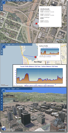
ESRI ArcGIS JavaScript Extension for Virtual Earth
ESRI just publicly released their a new version of their ArcGIS JavaScript Extension...using Virtual Earth. Now, you can leverage the powerful analytics and computational GIS models in ESRI ArcGIS Server and visualize this information on Microsoft Virtual Earth.
"The ArcGIS JavaScript™ Extension for Microsoft Virtual Earth™ allows you to extend the Microsoft Virtual Earth API™ to use ArcGIS Server services. With this extension, you can add your own data to the Microsoft Virtual Earth™ Map Control and embed this map in your own page. "
The ESRI ArcGIS JavaScript Extension for Virtual Earth Interactive SDK is now live and you can start writing applications against it today. The API includes the following features:
- Show a map
- Add a service from my ArcGIS Server
- Identify features on the map
- Identifying things on the map at a point
- Find features
- Finding features containing specified text
- Perform a query
- Using the Query Task
- Querying data using spatial relationships
- Searching for things within an area
- Querying data using a buffer
- Find addresses
- Use my ArcGIS GeocodeServer
- Get address at click location
- Add results to the map
- Adding shapes from results
- Not showing the result
- Work with Geoprocessing tasks
- Adding Geoprocessing results on the map
- Executing a synchronous task (Message in a bottle)
- Return a generated image (Surface profile)
- Project to a different coordinate system
- Project geometry to VEShapes
- Project VEShapes to another projection
- Get service information
- Discovering map services
- Discovering Geoprocessing services
- Getting information about a map service
- Using a REST request to get layer information
What a fantastic marriage of technologies! ESRI's relentless geodata processing with Virtual Earth's presentation layer. Does it get better than this? Perhaps. Are you going to the ESRI User Conference? I'm not going to miss a free ride to my home town. :)
CP
Comments
Anonymous
July 09, 2008
PingBack from http://blog.a-foton.ru/2008/07/esri-arcgis-javascript-extension-for-virtual-earth/Anonymous
July 25, 2008
Awwwwe yeah, I'm coming home San Diego! I love a free trip home. Microsoft Virtual Earth will have aAnonymous
July 29, 2008
Today, we're announcing a closer and much deeper relationship with ESRI by integrating Virtual Earth

