Simple GeoRSS utility library - released
I just uploaded the source code for this library, used in the Virtual Earth mash-up described in my previous post. You can browse/download it from here.
What you will find:
- A simple domain model for GeoRSS feeds with support for points, lines and polygons; links and icons
GeoRssData geoData = new GeoRssData("Mount Saint Helens", "Trailheads and campsites in the Mount Margaret area of Mt. Saint Helens, WA");
geoData.AddPoint( "Lakes Trailhead", "This is where we started our hike", 46.2913246, -122.2658157 );
**
polygon = geoData.AddPolygon("Coldwater Lake", "Formed by the 1980 eruption of Mount St. Helens.", "46.31409 -122.22616 46.31113 -122.22968 46.31083 -122.23320 46.29802 -122.25877 46.29245 -122.26641 46.29286 -122.26392 46.28746 -122.26744 46.28741 -122.26006 46.29049 -122.25955 46.29120 -122.25620 46.28924 -122.255430 46.30271 -122.23251 46.31284 -122.22315 46.31409 -122.22616")
polygon.Link = "https://somelink”;
…
The GeoRssData provides common methods for creating the shapes and passing the information (like coordinates). For example, AddLine and AddPolygon methods come in two versions: one that takes a Point[] and another that takes a string:
public GeoRssLineItem AddLine(string itemTitle, string itemDescription, Point[] line);
public GeoRssLineItem AddLine(string itemTitle, string itemDescription, string line);
The latter is convenient if you persist your information in a single field in a database for example, as I’m doing in LitwareHR.
There are also simple validations like point should have 2 coordinates, lines should have an even number of coordinates, strings should be parsed as doubles, etc.
- A GeoRSS builder that converts the model into a SyndicationFeed object:
SyndicationFeed feed = GeoRssFeedBuilder.GetFeed(geoData)
The feed can then be passed to Rss20FeedFormatter.
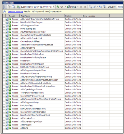
- Unit tests for all with +99% coverage:
 |
 |
- A very simple sample demonstrating how to use it (besides the tests which are self explanatory)
Final notes:
I liked the System.Xml.Linq classes very much. In my original implementation I assembled the Xml elements by hand, concatenating strings, etc. mainly because I couldn’t find a way of programmatically constructing them in the way Virtual Earth likes (e.g. all georss elements have to use the namespace “georss”, the elements must be fully qualified, etc.). Using XElement & XAttribute was straightforward and compact:
XNamespace grns = " https://www.georss.org/georss";
XElement x = new XElement(grns + "point", new XAttribute(XNamespace.Xmlns + "georss", grns.NamespaceName ), 10, 20 );
will serialize as:
<georss:point xmlns:georss=”https://www.georss.org/georss”>10 20</georss:point>
The model should be fairly simple to extend to include support for other elements (radius, etc). or even the broader set of attributes in the SyndicationFeed class and related cousins. I hope you find it useful.
Comments
Anonymous
July 04, 2008
PingBack from http://wordnew.acne-reveiw.info/?p=5090Anonymous
July 18, 2008
In this screencast, I build off of the concepts shown in my previous screencast and show you how to renderAnonymous
July 18, 2008
In this screencast, I build off of the concepts shown in my previous screencast and show you how to renderAnonymous
July 18, 2008
Marc Schweigert builds off of the concepts shown in his previous screencast and shows you how to renderAnonymous
July 18, 2008
Marc Schweigert builds off of the concepts shown in his previous screencast and shows you how to renderAnonymous
July 18, 2008
It’s been a good week for awesome content again here in Virtual Earth land. Marc Schweigert I swear is